To support radio network optimization, it is necessary that location-based information about the network quality, about interference effects and about the configurations of all surrounding network elements is intuitively and directly visible to the RF-optimizer. AnalyTo achieves this by embedding all relevant information layers, an intelligent and high-performance zooming concept and the use of the latest background data – such as satellite photos or building plans – in a GIS-like presentation.
Example: Insufficient supply a long a highway
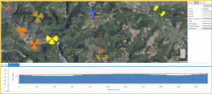
Step 1: Detection of problem spots through reporting & prioritization.
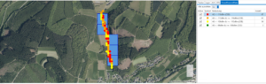
Step 2: Presentation and delimitation of the problem spot.
Step 3: Inclusion of the surrounding network elements.
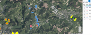
Step 4: Inclusion of geographic conditions, references become directly visible.